Christiansø’s geology
The formation of Bornholm and the formation of Christiansø (Ertholmene) are closely connected, as both islands are part of the southern boundary of the ancient Scandinavian Precambrian basement, also known as the Baltic Shield. Along this southern boundary, there is a giant fault zone that stretches from the Skagerrak strait through southern Sweden and the Baltic Sea and on, down to the Black Sea.
Bornholm and Ertholmene became two independent ‘fragments’ as they broke off from the old bedrock, and they are situated right in the middle of this large fault zone. The Scandinavian basement is found under large parts of Norway, all of Sweden and Finland as well as under the seabeds in the northern section of the Baltic Sea.
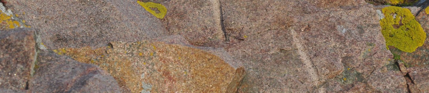
Ertholmene and much of Bornholm are made up of 1400–1700-million-year-old granite. Ertholmene’s granite can best be compared to the granite found at Hammerknude in north-west Bornholm. And yet, there are significant differences. Hammerknude granite is characterised by red markings caused by iron precipitation in the mineral grains. These markings are rarely seen in Ertholmene granite, and the grain size is generally smaller. It is therefore uncertain whether it is the same body of granite or an indication that Ertholmene is actually an independent detached piece of the basement block.

As you walk on the granite surface, you can see that it has been ground down and smoothed by the movements of the ice flow; glacial striations are visible in many places on the islands, as are sickle-shaped marks left by the ice.
In addition to the many pegmatites (areas or pockets of mineral grains in the granite that are larger than 1 metre), a sharp observer might also see cracks filled with sandstone, so-called sandstone fissures. One sandstone fissure is visible on Frederiksø, while on Græsholm there are many visible fissures, including one that is more than a metre wide and said to be the widest in Denmark. These fissures were formed millions of years ago when sand washed down into the open cracks and then hardened.
WATER AFTER MORE THAN 300 YEARS
Finding good drinking water deep down in the ancient geological bedrock is not something that happens every day! Even for a seasoned geologist like me, it was a huge experience and one of those entirely unique professional achievements.
Klaus Fynbo Hansen, geologist and cottage guest

In 2006, nine deep boreholes were drilled in the fissures based on the theory that there might be water reservoirs. The theory proved true; at a depth of approximately 50 metres, enough water was found to make the island basically self-sufficient in drinking water. This appears to be the end of the centuries-old practice of sourcing water from the natural rainwater reservoirs on the island (created when the rocks were blasted to build the fortress).
Today the island water supply consists of a combination of extraction of groundwater (15–20%) and desalination (osmosis) of seawater (80–85%).